What You'll Learn
Course Benefits
Industry Certification
Internationally recognized qualification
Expert Instructors
Learn from industry professionals
Dedicated Support
Assistance during and after training
Practical Skills
Apply knowledge immediately
Course Overview
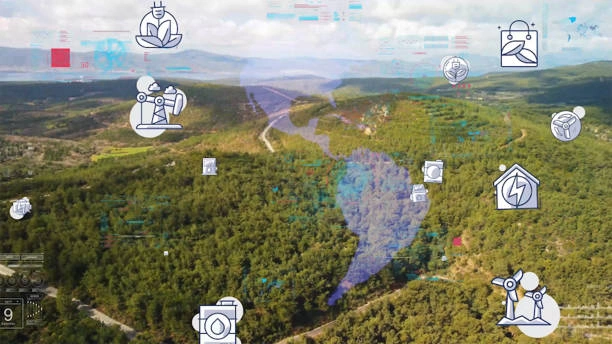
FeaturedRemote sensing imagery is critical for modern mapping, environmental monitoring, resource management, and decision-making. This course provides professionals with knowledge of image acquisition methods, sensor technologies, platforms, and data quality considerations. Participants will learn to select appropriate acquisition strategies, integrate data from multiple sources, and ensure high-quality spatial datasets for analysis and operational use.
The course emphasizes practical application and strategic decision-making, enabling participants to optimize remote sensing workflows and enhance organizational capabilities in geospatial data acquisition.
Duration
5 Days
Who Should Attend
-
GIS and remote sensing specialists
-
Environmental and natural resource analysts
-
Urban and regional planners
-
Surveyors and mapping professionals
-
Data scientists and geospatial analysts
-
Policy advisors and decision-makers using spatial data
Course Impact
Personal Impact
-
Enhances technical skills in remote sensing data acquisition and interpretation
-
Builds expertise in selecting and using appropriate sensors and technologies
-
Improves decision-making and analytical capabilities in spatial projects
Organizational Impact
-
Strengthens data-driven planning and monitoring
-
Improves quality and reliability of spatial datasets
-
Supports efficient resource management, environmental monitoring, and operational decision-making
Course Objectives
By the end of this course, participants will be able to:
-
Understand principles of remote sensing and image acquisition
-
Identify and use different types of sensors and platforms (satellite, UAV, aerial)
-
Evaluate data quality, resolution, and suitability for various applications
-
Integrate multi-source remote sensing datasets for analysis
-
Implement best practices for remote sensing project planning and execution
Course Outline
Module 1: Introduction to Remote Sensing and Image Acquisition
-
Fundamentals of remote sensing and electromagnetic spectrum
-
Types of remote sensing: passive vs active
-
Overview of platforms: satellites, UAVs, aerial imagery
-
Data acquisition workflow and mission planning
-
Case Study: Satellite imagery acquisition for environmental monitoring
-
Practical Exercise: Assessing data requirements for a specific project
Module 2: Sensors and Platforms for Image Acquisition
-
Optical, radar, LiDAR, and multispectral sensors
-
Satellite constellations and UAV systems
-
Resolution types: spatial, spectral, temporal, radiometric
-
Platform selection criteria for different applications
-
Case Study: UAV imagery for precision agriculture
-
Practical Exercise: Choose sensors and platforms for a hypothetical mapping project
Module 3: Image Quality and Preprocessing
-
Factors affecting image quality: atmospheric, geometric, radiometric
-
Calibration and correction techniques
-
Data preprocessing for analysis
-
Data formats, storage, and metadata considerations
-
Case Study: Preprocessing satellite imagery for urban analysis
-
Practical Exercise: Conduct geometric and radiometric corrections on sample images
Module 4: Multi-Source Data Integration
-
Combining imagery from different sensors and platforms
-
Data fusion techniques and interoperability
-
Managing spatial and temporal discrepancies
-
Applications in environmental monitoring, disaster management, and planning
-
Case Study: Integrating optical and radar imagery for flood assessment
-
Practical Exercise: Fuse multi-source data to create a composite map
Module 5: Planning and Implementing Remote Sensing Projects
-
Project planning and workflow management
-
Cost, time, and resource considerations
-
Data acquisition ethics, licensing, and compliance
-
Strategic applications for decision-making and reporting
-
Case Study: Planning a regional land-use monitoring project
-
Practical Exercise: Develop a remote sensing acquisition plan for a chosen application
Prerequisites
Course Administration Details
Customized Training
This training can be tailored to your institution needs and delivered at a location of your choice upon request.
Requirements
Participants need to be proficient in English.
Training Fee
The fee covers tuition, training materials, refreshments, lunch, and study visits. Participants are responsible for their own travel, visa, insurance, and personal expenses.
Certification
Upon successful completion of this course, participants will be issued with a certificate from Ideal Workplace Solutions certified by the National Industrial Training Authority (NITA) under License NO: NITA/TRN/2734.
Accommodation
Accommodation can be arranged upon request. Contact via email for reservations.
Payment
Payment should be made before the training starts, with proof of payment sent to outreach@idealworkplacesolutions.org.
For further inquiries, please contact us on details below:
Email: outreach@idealworkplacesolutions.org
Mobile: +254759708394
Register for the Course
Select a date and location that works for you.
In-Person Training Schedules
January 2026
| Date | Days | Venue | Fee (VAT Incl.) | Register |
|---|---|---|---|---|
| 5 Jan - 9 Jan 2026 | 5 days | Nairobi, Kenya | KES 99,000 | USD 1,400 | Enroll Now |
| 5 Jan - 9 Jan 2026 | 5 days | Cape Town, South Africa | USD 3,500 | Enroll Now |
| 5 Jan - 9 Jan 2026 | 5 days | Dubai, United Arabs Emirates | USD 4,000 | Enroll Now |
| 5 Jan - 9 Jan 2026 | 5 days | Zanzibar, Tanzania | USD 2,200 | Enroll Now |
| 12 Jan - 16 Jan 2026 | 5 days | Mombasa, Kenya | KES 115,000 | USD 1,500 | Enroll Now |
| 12 Jan - 16 Jan 2026 | 5 days | Kigali, Rwanda | USD 1,800 | Enroll Now |
| 12 Jan - 16 Jan 2026 | 5 days | Accra, Ghana | USD 5,950 | Enroll Now |
| 12 Jan - 16 Jan 2026 | 5 days | Kampala, Uganda | USD 2,200 | Enroll Now |
| 19 Jan - 23 Jan 2026 | 5 days | Dar es Salaam, Tanzania | USD 2,000 | Enroll Now |
| 19 Jan - 23 Jan 2026 | 5 days | Johannesburg, South Africa | USD 3,100 | Enroll Now |
| 19 Jan - 23 Jan 2026 | 5 days | Nakuru, Kenya | KES 105,000 | USD 1,400 | Enroll Now |
| 19 Jan - 23 Jan 2026 | 5 days | Dakar, Senegal | USD 3,500 | Enroll Now |
| 26 Jan - 30 Jan 2026 | 5 days | Pretoria, South Africa | USD 3,100 | Enroll Now |
| 26 Jan - 30 Jan 2026 | 5 days | Kisumu, Kenya | KES 105,000 | USD 1,500 | Enroll Now |
| 26 Jan - 30 Jan 2026 | 5 days | Naivasha, Kenya | KES 105,000 | USD 1,400 | Enroll Now |
| 26 Jan - 30 Jan 2026 | 5 days | Arusha, Tanzania | USD 2,000 | Enroll Now |
USD 1,400
Request Custom Training
We offer customized training solutions tailored to your organization's specific needs:
- Training at your preferred location
- Customized content to address your specific challenges
- Flexible scheduling to accommodate your team
- Cost-effective solution for training multiple employees
Early-bird Offer
Special pricing ends in:
Recent Activity
Additional Options
Customize your training experienceFrequently Asked Questions
Find answers to common questions about this course
You May Also Be Interested In
Explore more courses in this category
 Intermediate
Training on Advanced Spatial Analysis with GIS
Master advanced spatial analysis with GIS. Learn to conduct complex spatial anal...
 Intermediate
Training on Introduction to Open Source GIS Tools
Master open-source GIS tools like QGIS and GRASS GIS. Learn to analyze geospatia...
 Advanced
Training on LiDAR for Advanced Spatial Analysis: Data Processing and 3D Modeling
Master LiDAR for spatial analysis. This course provides key skills to process da...
 Intermediate
Training on Field GIS & Mobile Data Collection (Survey123, FieldMaps & ODK)
Learn how to design, deploy, and manage mobile data collection systems using Sur...
Intermediate
Training on Advanced Spatial Analysis with GIS
Master advanced spatial analysis with GIS. Learn to conduct complex spatial anal...
Intermediate
Training on Introduction to Open Source GIS Tools
Master open-source GIS tools like QGIS and GRASS GIS. Learn to analyze geospatia...
Advanced
Training on LiDAR for Advanced Spatial Analysis: Data Processing and 3D Modeling
Master LiDAR for spatial analysis. This course provides key skills to process da...
Intermediate
Training on Field GIS & Mobile Data Collection (Survey123, FieldMaps & ODK)
Learn how to design, deploy, and manage mobile data collection systems using Sur...
Training on Remote Sensing Image Acquisition: Methods and Technologies
Next class starts 5 Jan 2026

Subscribe to our Weekly Newsletter!
Get updates on the latest posts and more from Ideal Workplace Solutions straight to your inbox.
About Us
Take your career to the next level with our industry-leading training programs. Designed to build skills, boost confidence and drive success, we empower professionals like you to excel in your current role or explore new opportunities.
Quick Links