What You'll Learn
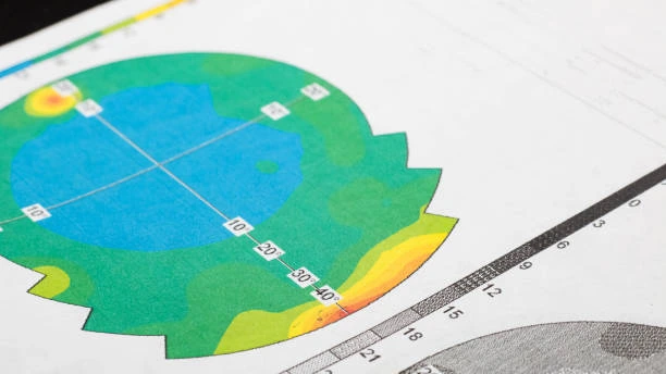
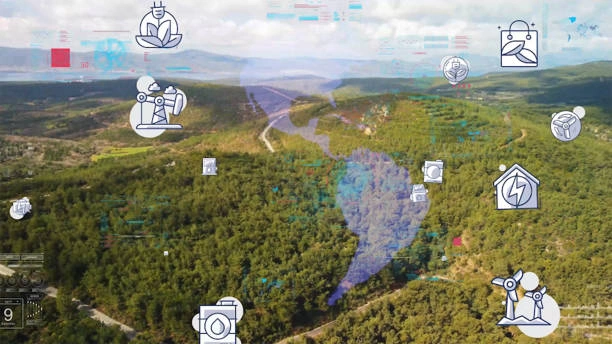
Master geostatistical modeling for spatial data analysis. Learn to analyze spatially referenced data, predict values at unsampled locations, and understand spatial patterns.
Course Benefits
Industry Certification
Internationally recognized qualification
Expert Instructors
Learn from industry professionals
Dedicated Support
Assistance during and after training
Practical Skills
Apply knowledge immediately
Course Overview
FeaturedThis course provides a comprehensive introduction to geostatistics, focusing on the analysis and interpretation of spatial data. Participants will learn essential concepts and techniques used in geostatistics to model and predict spatial phenomena. The course covers various methods for analyzing spatial patterns, understanding spatial dependence, and making informed decisions based on spatial data. Practical exercises using software tools will reinforce the theoretical concepts, making participants proficient in applying geostatistical methods to real-world problems.
Course Duration
10 Days
Who Should Attend
- GIS professionals looking to enhance their skills in spatial data analysis
- Environmental scientists and ecologists dealing with spatial data
- Geographers and urban planners
- Researchers in natural resources, agriculture, and forestry
- Data scientists and statisticians interested in spatial data analysis
- Engineers and geoscientists working with spatial data
Course Impact
Organisational Impact
-
Strengthens capacity to analyze and model spatial data for better decision-making.
-
Enhances predictive capabilities in fields such as environmental management, agriculture, forestry, and urban planning.
-
Reduces uncertainty in project planning by applying geostatistical methods to real-world data.
-
Builds institutional expertise in advanced spatial modeling, improving the quality of research and analysis.
-
Supports innovation and efficiency in projects through data-driven, evidence-based insights.
Personal Impact
-
Equips participants with practical skills in geostatistical methods for spatial data analysis.
-
Expands career opportunities in GIS, environmental science, geoscience, and data science.
-
Builds confidence in modeling, predicting, and interpreting spatial phenomena.
-
Provides hands-on experience with software tools for geostatistical analysis.
-
Empowers participants to apply advanced statistical techniques to solve complex spatial problems.
Course Objectives
By the end of this course, participants will be able to:
- Understand the fundamental concepts of geostatistics and spatial data analysis.
- Apply geostatistical methods to model and analyze spatial data.
- Perform spatial interpolation using techniques such as kriging.
- Evaluate spatial patterns and dependence in data.
- Use geostatistical software tools for spatial data analysis.
- Integrate geostatistical methods into decision-making processes.
- Develop spatial prediction models for various applications.
- Assess the accuracy and reliability of spatial models.
- Visualize and interpret spatial data effectively.
- Implement geostatistical techniques in practical case studies.
Course Outline
Module 1: Introduction to Geostatistics
- Basic concepts of spatial data
- Spatial autocorrelation and variograms
- Exploratory data analysis for spatial data
Module 2: Variogram Modeling
- Variogram estimation methods
- Variogram model fitting
- Anisotropy in spatial data
Module 3: Ordinary Kriging
- Theory of ordinary kriging
- Kriging variance
- Block kriging
Module 4: Universal Kriging
- Universal kriging model
- Trend estimation
- Residual kriging
Module 5: Indicator Kriging
- Indicator kriging for categorical data
- Probability of exceedance maps
Module 6: Cokriging
- Cokriging for multiple variables
- Cross-variogram modeling
Module 7: Sequential Gaussian Simulation
- Conditional simulation techniques
- Monte Carlo simulation
- Uncertainty assessment
Module 8: Spatial Regression
- Spatial lag models
- Spatial error models
- Mixed models for spatial data
Module 9: Geostatistical Applications in Environmental Science
- Soil contamination mapping
- Groundwater modeling
- Air pollution assessment
Module 10: Geostatistical Applications in Other Fields
- Disease mapping
- Natural resource management
- Remote sensing data analysis
Prerequisites
Course Administration Details
Customized Training
This training can be tailored to your institution needs and delivered at a location of your choice upon request.
Requirements
Participants need to be proficient in English.
Training Fee
The fee covers tuition, training materials, refreshments, lunch, and study visits. Participants are responsible for their own travel, visa, insurance, and personal expenses.
Certification
Upon successful completion of this course, participants will be issued with a certificate from Ideal Workplace Solutions certified by the National Industrial Training Authority (NITA) under License NO: NITA/TRN/2734.
Accommodation
Accommodation can be arranged upon request. Contact via email for reservations.
Payment
Payment should be made before the training starts, with proof of payment sent to outreach@idealworkplacesolutions.org.
For further inquiries, please contact us on details below:
Email: outreach@idealworkplacesolutions.org
Mobile: +254759708394
Register for the Course
Select a date and location that works for you.
In-Person Training Schedules
January 2026
| Date | Days | Venue | Fee (VAT Incl.) | Register |
|---|---|---|---|---|
| 5 Jan - 16 Jan 2026 | 10 days | Nairobi, Kenya | KES 198,000 | USD 2,800 | Enroll Now |
| 5 Jan - 16 Jan 2026 | 10 days | Cape Town, South Africa | USD 7,500 | Enroll Now |
| 5 Jan - 16 Jan 2026 | 10 days | Dubai, United Arabs Emirates | USD 8,000 | Enroll Now |
| 5 Jan - 16 Jan 2026 | 10 days | Zanzibar, Tanzania | USD 4,400 | Enroll Now |
| 12 Jan - 23 Jan 2026 | 10 days | Mombasa, Kenya | KES 230,000 | USD 3,000 | Enroll Now |
| 12 Jan - 23 Jan 2026 | 10 days | Kigali, Rwanda | USD 3,800 | Enroll Now |
| 12 Jan - 23 Jan 2026 | 10 days | Accra, Ghana | USD 7,200 | Enroll Now |
| 12 Jan - 23 Jan 2026 | 10 days | Kampala, Uganda | USD 3,800 | Enroll Now |
| 19 Jan - 30 Jan 2026 | 10 days | Dar es Salaam, Tanzania | USD 4,300 | Enroll Now |
| 19 Jan - 30 Jan 2026 | 10 days | Johannesburg, South Africa | USD 6,500 | Enroll Now |
| 19 Jan - 30 Jan 2026 | 10 days | Nakuru, Kenya | KES 210,000 | USD 2,800 | Enroll Now |
| 19 Jan - 30 Jan 2026 | 10 days | Dakar, Senegal | USD 6,000 | Enroll Now |
| 26 Jan - 6 Feb 2026 | 10 days | Pretoria, South Africa | USD 6,300 | Enroll Now |
| 26 Jan - 6 Feb 2026 | 10 days | Kisumu, Kenya | KES 210,000 | USD 3,000 | Enroll Now |
| 26 Jan - 6 Feb 2026 | 10 days | Naivasha, Kenya | KES 210,000 | USD 2,800 | Enroll Now |
| 26 Jan - 6 Feb 2026 | 10 days | Arusha, Tanzania | USD 4,300 | Enroll Now |
USD 3,000
USD 2,800
Request Custom Training
We offer customized training solutions tailored to your organization's specific needs:
- Training at your preferred location
- Customized content to address your specific challenges
- Flexible scheduling to accommodate your team
- Cost-effective solution for training multiple employees
Early-bird Offer
Special pricing ends in:
Recent Activity
Additional Options
Customize your training experienceFrequently Asked Questions
Find answers to common questions about this course
You May Also Be Interested In
Explore more courses in this category
Training on GIS Mapping & Digital Tools for Road Asset Management
Professional training on GIS mapping and digital tools for efficient road asset...
 Intermediate
Training on GIS and Remote Sensing for Climate Change Impact Analysis and Adaptation
Build practical skills in using spatial and satellite data to support climate re...
 Advanced
Training on GIS Mapping and Spatial Analysis for Disease Surveillance & Monitoring
Enhance disease surveillance with our GIS Mapping & Spatial Analysis training. L...
 Advanced
Training on Advanced GIS Techniques for Environmental Impact Assessment (EIA)
Master advanced GIS techniques for environmental impact assessment (EIA). Learn...
Training on GIS Mapping & Digital Tools for Road Asset Management
Professional training on GIS mapping and digital tools for efficient road asset...
Intermediate
Training on GIS and Remote Sensing for Climate Change Impact Analysis and Adaptation
Build practical skills in using spatial and satellite data to support climate re...
Advanced
Training on GIS Mapping and Spatial Analysis for Disease Surveillance & Monitoring
Enhance disease surveillance with our GIS Mapping & Spatial Analysis training. L...
Advanced
Training on Advanced GIS Techniques for Environmental Impact Assessment (EIA)
Master advanced GIS techniques for environmental impact assessment (EIA). Learn...
Training on Geostatistical Modeling for Spatial Data Analysis
Next class starts 5 Jan 2026

Subscribe to our Weekly Newsletter!
Get updates on the latest posts and more from Ideal Workplace Solutions straight to your inbox.
About Us
Take your career to the next level with our industry-leading training programs. Designed to build skills, boost confidence and drive success, we empower professionals like you to excel in your current role or explore new opportunities.
Quick Links